Toll calculator can be used to calculate the estimated toll for a given route.
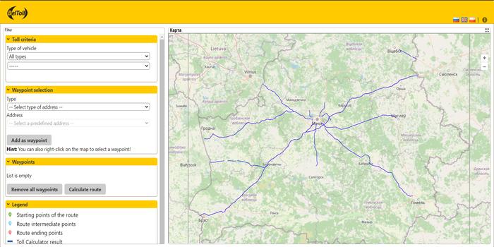
Figure 1 Toll calculator start mask

Figure 2 Main toolbar
· Switch language
By clicking on the respective flag the interface language will be changed accordingly.

· Help information
By clicking on the
 symbol, the reference information is displayed.
Figure 3 Map navigation toolbar
· Zoom out
 a selected area on the map
· Zoom in
 a selected area on the map
The user has the opportunity to use the application in different available browsers.
The user can switch the language of the web site. By default the web site uses the language of the operators web site. If the Toll Calculator is started externally (not from the embedded link of the operators website) the language of the user's web browser is used (or English, if browser language is not supported).
First of all, you need to choose a way to search for an address. Therefore, select the "Find predefined address" option, which will then be highlighted in yellow.
Figure
4 Find predefined address
The next step is to select the address type. When you click on this field, the drop-down list displays possible address types
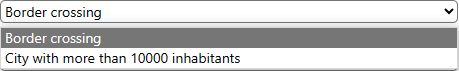
![]()
Figure
5 Different types of addresses
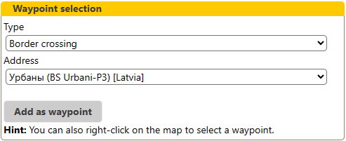
After selecting the address type, the corresponding addresses will be displayed in the drop-down list in the field
 .
.
Figure 6 gives an example for the drop-down list of predefined addresses for the address type “Border crossing”
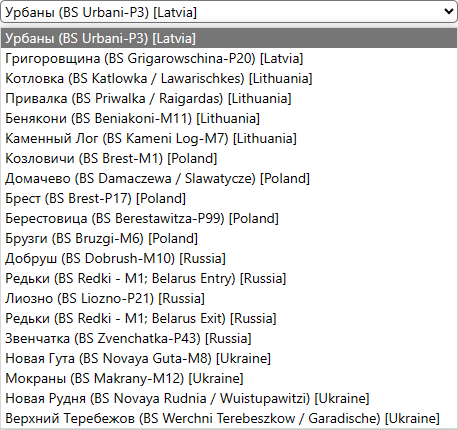
Figure
6 Drop-down list of specified addresses
It is also possible to search for an address using a map.
Move the mouse to a specific location on the map and click the right mouse button as shown in Figure 8. Here you can take the opportunity to find the address of a specific point on the map. When selecting the “Set waypoint” option (see Figure 7).
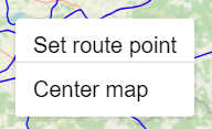
Figure 7 Finding an address
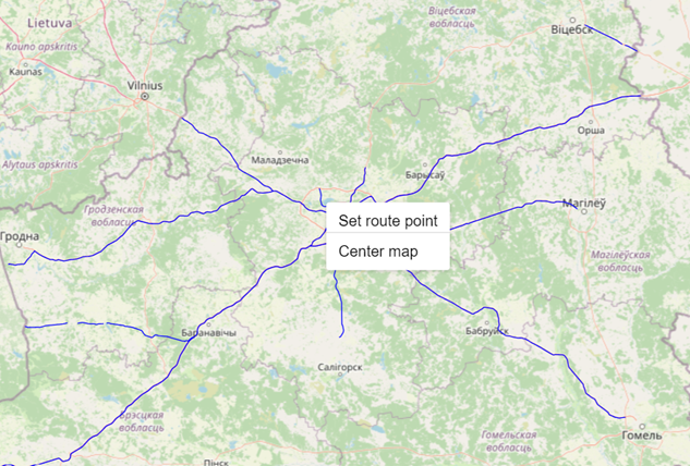
Figure 8 Finding an address using a map
The main purpose of the application is to calculate the approximate amount of payment and display the results to the user.
The route and payment information will be displayed on the map.
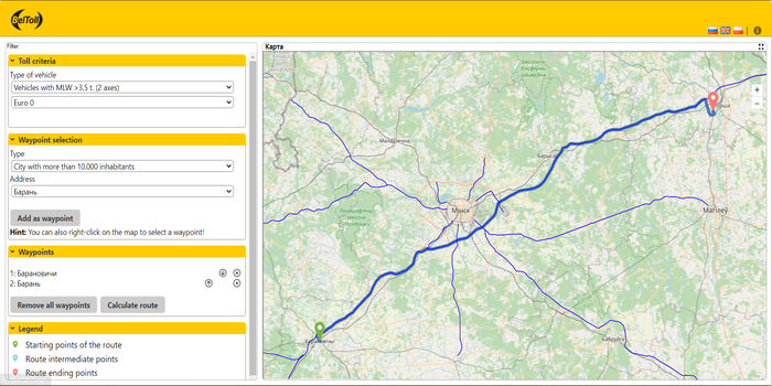
Figure 9 Toll Calculator
The result of the payment calculation is displayed in a separate window. This result contains information about the following parameters:
· Toll criteria such as type of vehicle, number of axles and emission class
· Waypoints are listed with their position (longitude and latitude parameters)
· Calculated result on route length, tolled and non-tolled route length, estimated time enroute
· Detailed information on tolled route such as tolled length and total amount
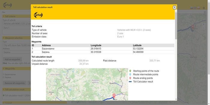
Figure
10 Toll calculation result